It having been almost a month since my last adventure, I was very happy to be outside hiking again. Reflecting on it, this trip divided very neatly split into 4 parts.
The first part started, as it usually does, at the beginning. This day’s adventure began in a parking lot at the edge of the Scarborough Brook Conservation Area, but rather than head off into the trees along a nearby pond, it proceeded to follow the road downhill for about three miles. This was the longest road walk in the MA NET, so I’d decided I would rather get it over with first so I could end on a pleasant woody stroll instead.
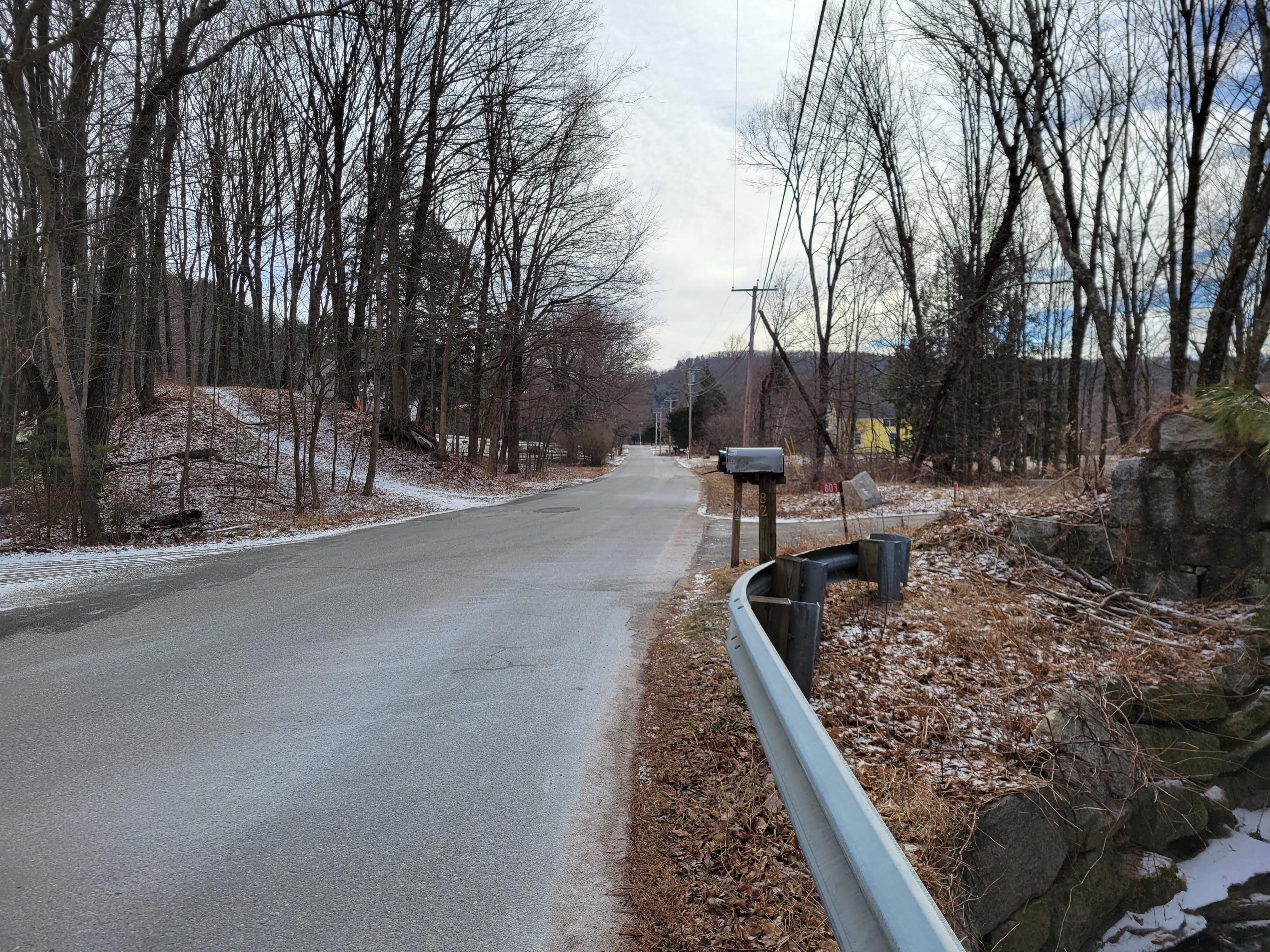
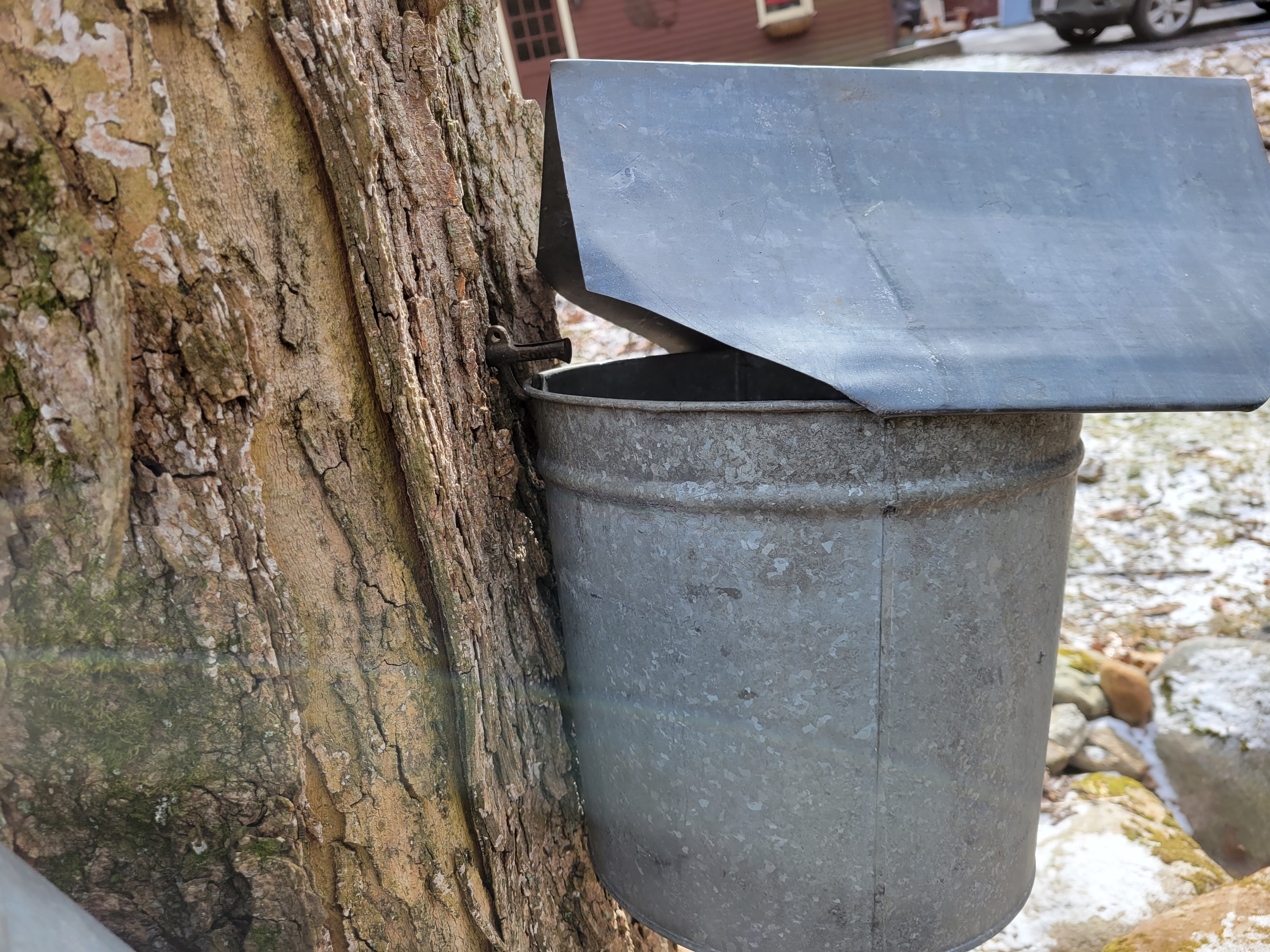
As far as road walks go, it could have been a lot worse, but it was still the least pleasant part of the hike. There weren’t many cars as I walked passed various driveways of houses not quite nestled into the woods. The road followed a nice creek for a little ways, and I noticed some trees that had been tapped, with buckets attached to collect syrup. The combination of descending terrain and hard asphalt had my knee acting up before too long. I worried that if it kept up I might not finish the hike, but fortunately it calmed down around the time I reached the end of the road walk.
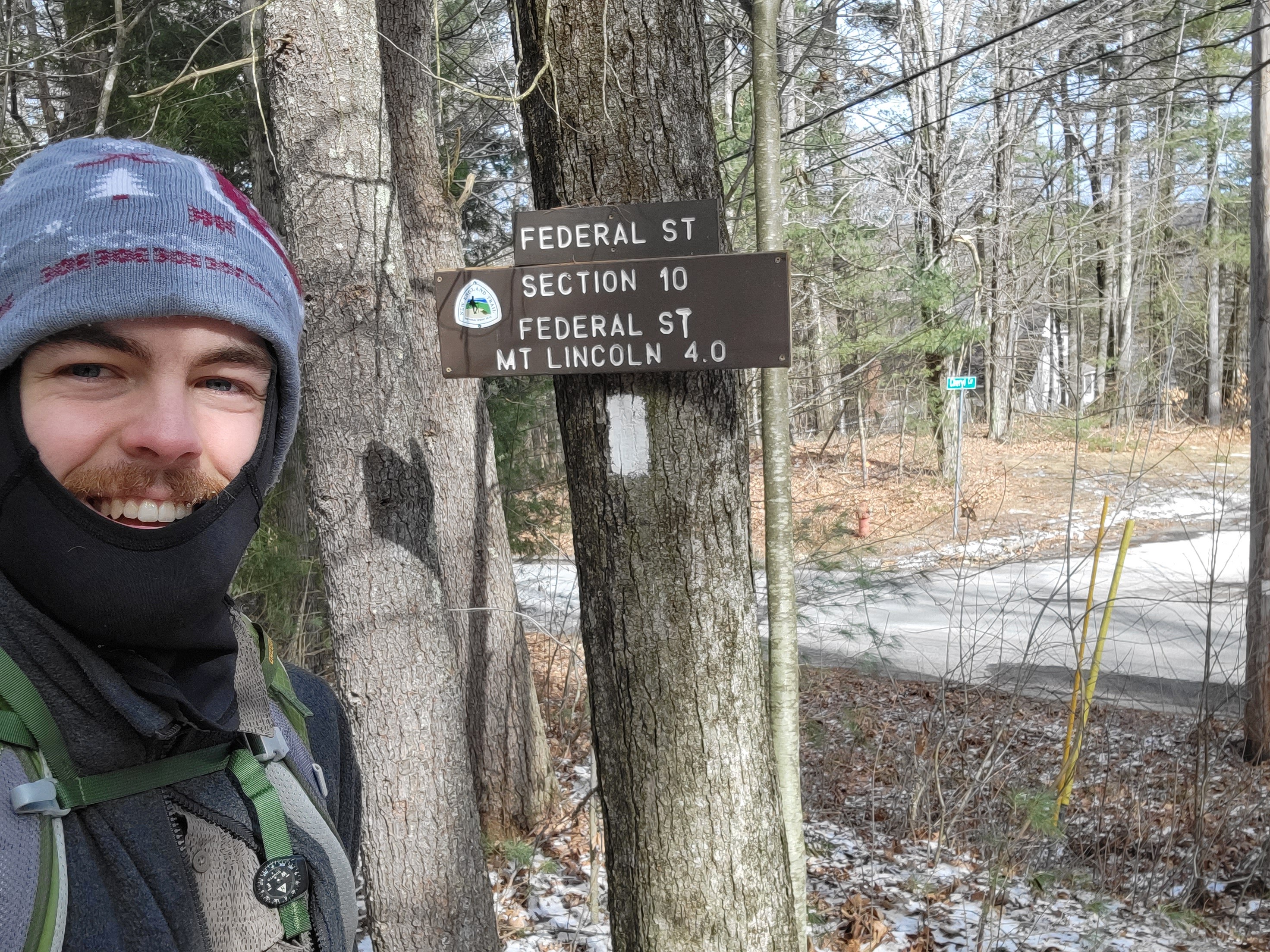
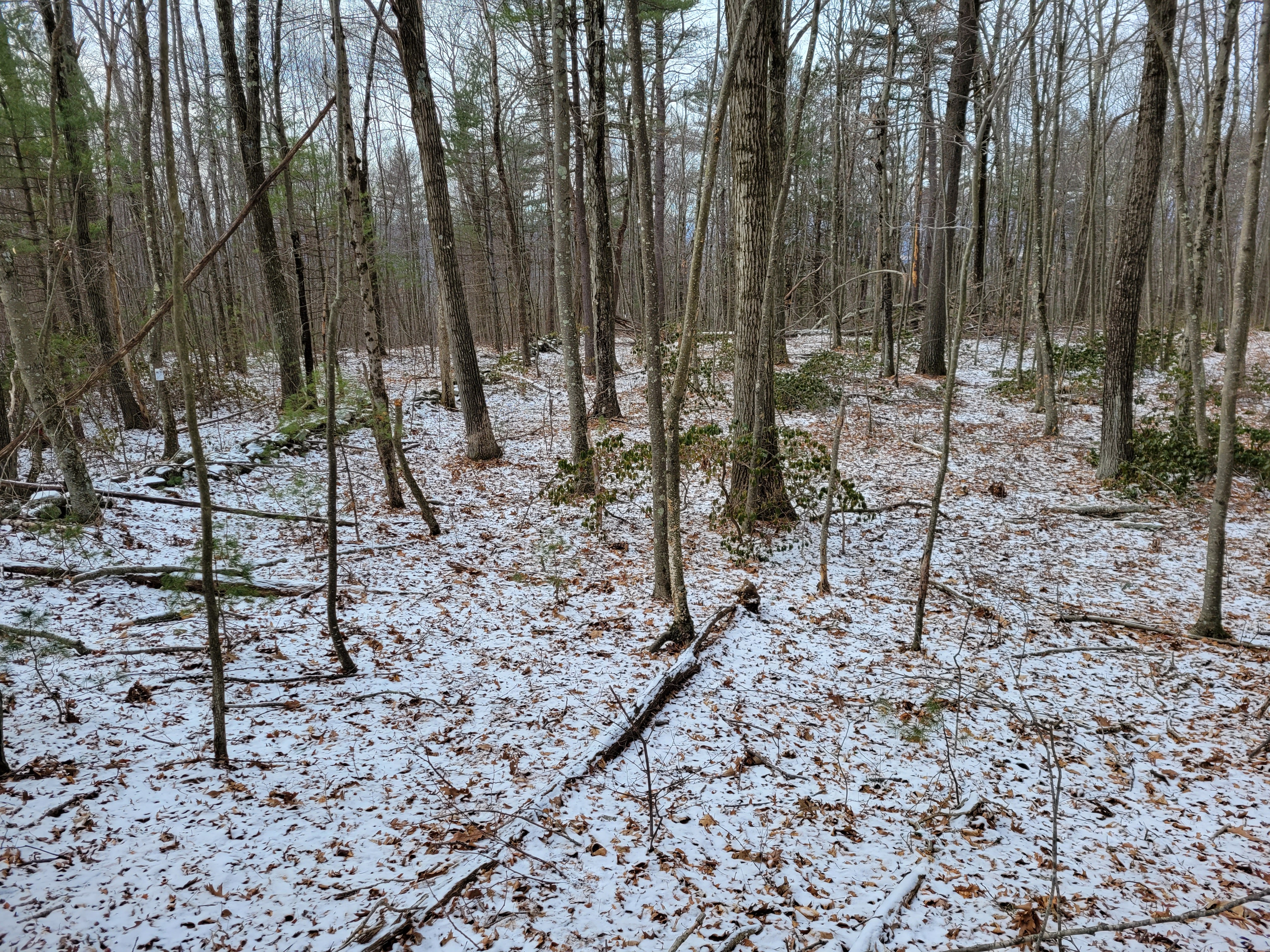
Part two started just after I reached the turn-around point of my frigid hike with Maria, where the trail finally left paved roads behind and entered the woods. The next mile or so was wonderful as the trail roughly followed along a creek up towards Mt. Lincoln. A light dusting of snow covered the ground, but didn’t impede my movement. I crossed a road and entered the Holland Glen Conservation Area, a small nature preserve nestled along the creek drainage. I love the sheltered, cozy feel I get in these shallow creek runs.

In addition to the picturesque environment, I also learned two useful pieces of information through here. First, a sign at the entrance to the conservation area described how the positioning of doubled blazes on trees indicates a turn in the trail. I felt a little silly that I hadn’t realized this until now, but you have to learn things sometime. Second, I learned that when wearing a backpack, my body is frustratingly effective at blocking the signal between my continuous glucose monitor and my insulin pump. Since the start of the hike, my pump, sitting in my pocket, hadn’t been getting any signal from the CGM on my opposite arm. After an hour and a half, I decided I should try to do something about it, and moved my pump to the pocket on the same side of my body as the CGM. Signal miraculously restored, and knowledge was gained.
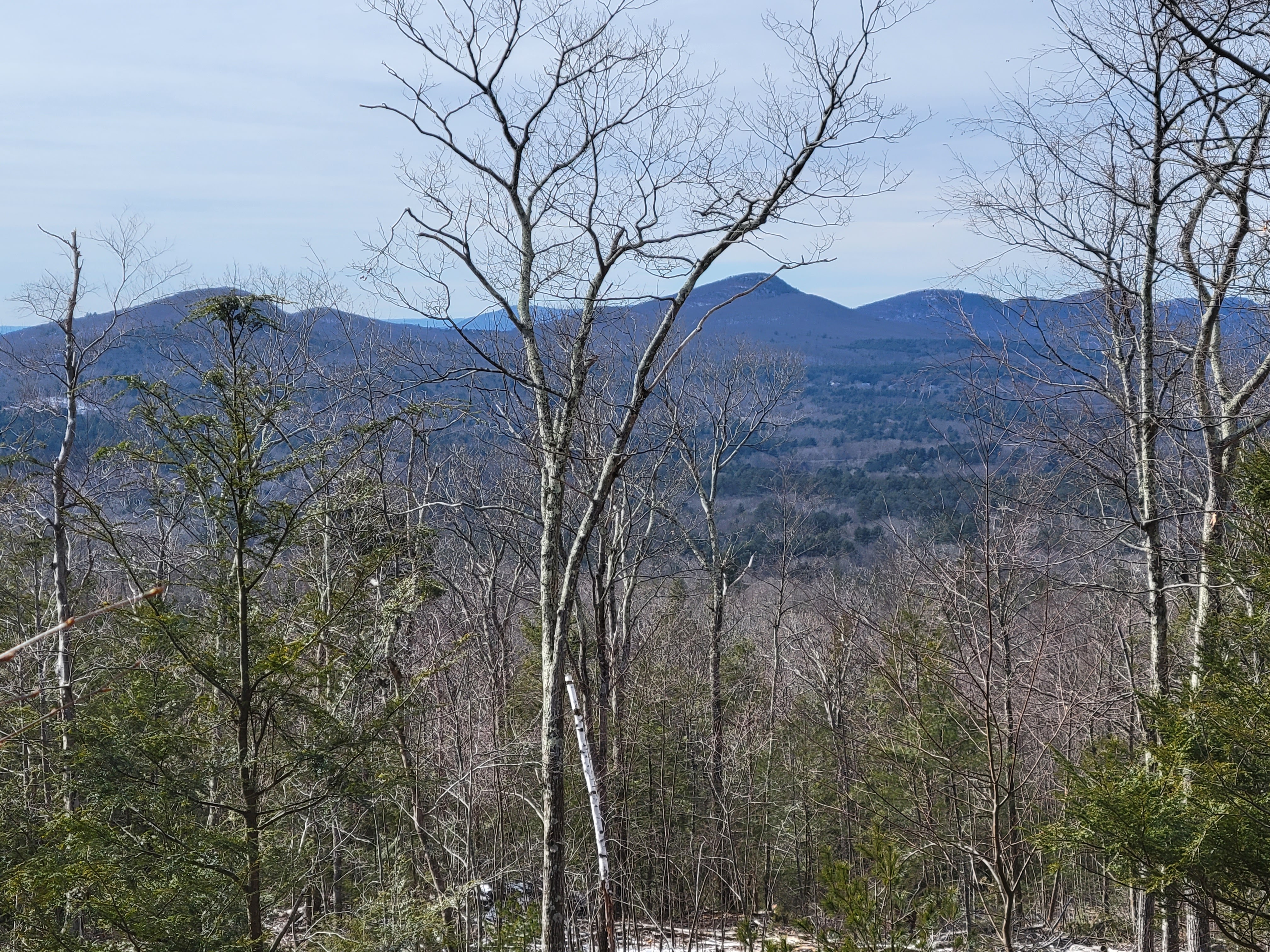
Leaving the creek, I continued climbing and soon found myself in an area which looked to have been partially harvested for timber recently. Because the official NET had rerouted to the road, I was slightly worried that the path wouldn’t be accessible, but my worries were unfounded. The trail was open and easy to follow, and the thinned trees revealed the landscape, making for the best views of the hike. I could see the whole of the Mt. Holyoke Range stretching out to the west, and I was filled with a sense of accomplishment seeing the land through which I had previously trod.
About two miles after I left the paved roads behind, the dirt trail turned into a disused gravel road, marking the beginning of the third section of my adventure. I was supposed to follow the road for a little over a tenth of a mile before the trail went of to my left and into the trees, but after traveling twice that far with no sign of the trail, I decided it was time to make my own way. Fortunately winter had left the understory relatively open and unobstructed, so the bushwhacking was easy and required almost no whacking of bushes. I’d hoped I’d come across the proper trail relatively quickly, but it did not seem to exist. I passed some old stone walls, a remnant of early 19th century agriculture, and had to avoid only one stand of trees which was too dense to pass through.
After about a mile of hiking through long abandoned farmland, I recovered the trail and transitioned to the final leg of my journey. The trail was now easy to follow, first as a snowmobile track, and then as a simple, well maintained path. My pace picked up, and I was able to zone out as I hiked, entering into a pleasant, pseudo-meditative state for the remaining three miles. Time and distanced passed quickly as I absorbed the world around me, drifting slowly from one thought to the next like leaves in a gently flowing stream. The summit of Mt. Lincoln was unimpressive, lacking in views and covered in radio towers and other signaling infrastructure, but I remained happy and relaxed.
The remainder of the trail skirted near a few houses before reentering the Scarborough Brook Conservation Area. I returned to my car in this peaceful state, three and a half hours after I had left it, and began my drive home.
Hike Details
- Date: Sunday, February 20th, 2022
- Distance: 8.57 miles
- Route: https://www.alltrails.com/explore/map/map-february-21-2022-3-53-pm-a9e18cb
