It had been far too long since my last mile-eating hike. I think almost two months. Taking it slow and stopping for frequent breaks and pictures has its place, as I’ve mentioned before, but sometimes I just need to hike long and fast, breathing hard and aching. Today I filled that need.
When planning for today’s adventure, I knew I didn’t want to drive too far, so I figured it would be a good day to continue filling out sections of the New England Trail. I’d made it as far south as Goat Peak in Mount Tom State Reservation in August, but rather than start there and continue south, I started my morning parked at the Whiting Reservoir Trailhead, planning to loop north to Goat Peak and back.
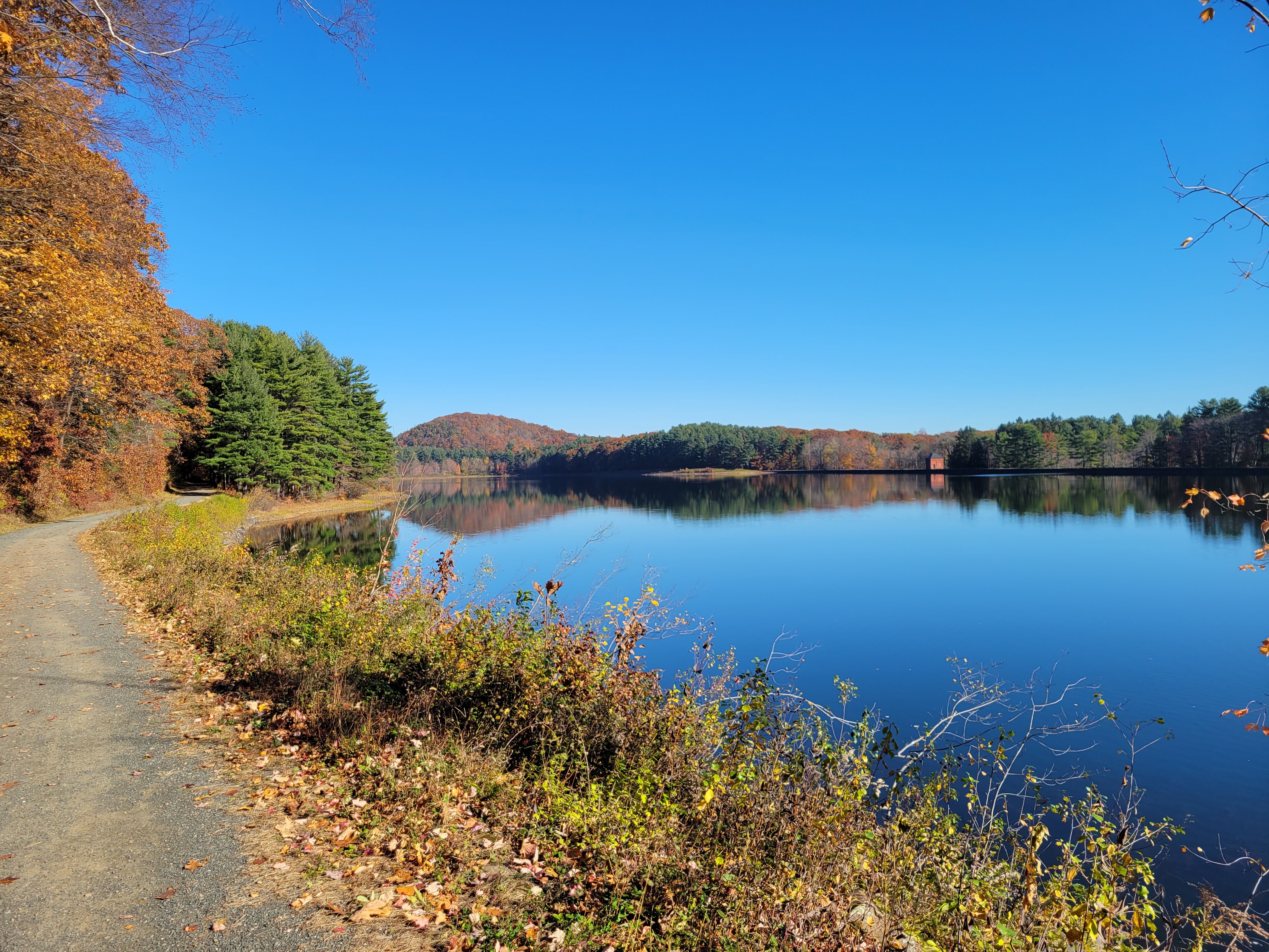
The last week has finally seen freezing nighttime temperatures arrive in Springfield, so while the clear sky promised a bright and relatively warm day ahead, parts of the ground were still frosted as I left the warmth of my car at 10:00. The first section of the day took me to a gravel road along the western edge of the Whiting Street Reservoir. The views across the reservoir were pleasant, and I spotted a handful of ducks swimming around. It seemed a good number of other folks also thought it was good morning to be out, since I ran across at least half a dozen people circling the reservoir and spotted more on the other side.
By the time I passed the reservoir I was getting warm enough to remove my fleece, and soon came across a disused paved road and some old, abandoned buildings. After a quick look inside, I became curious about their original purpose. Fortunately, a few more feet down the trail a view of a large quarry opened up, strongly implying an answer to my question.
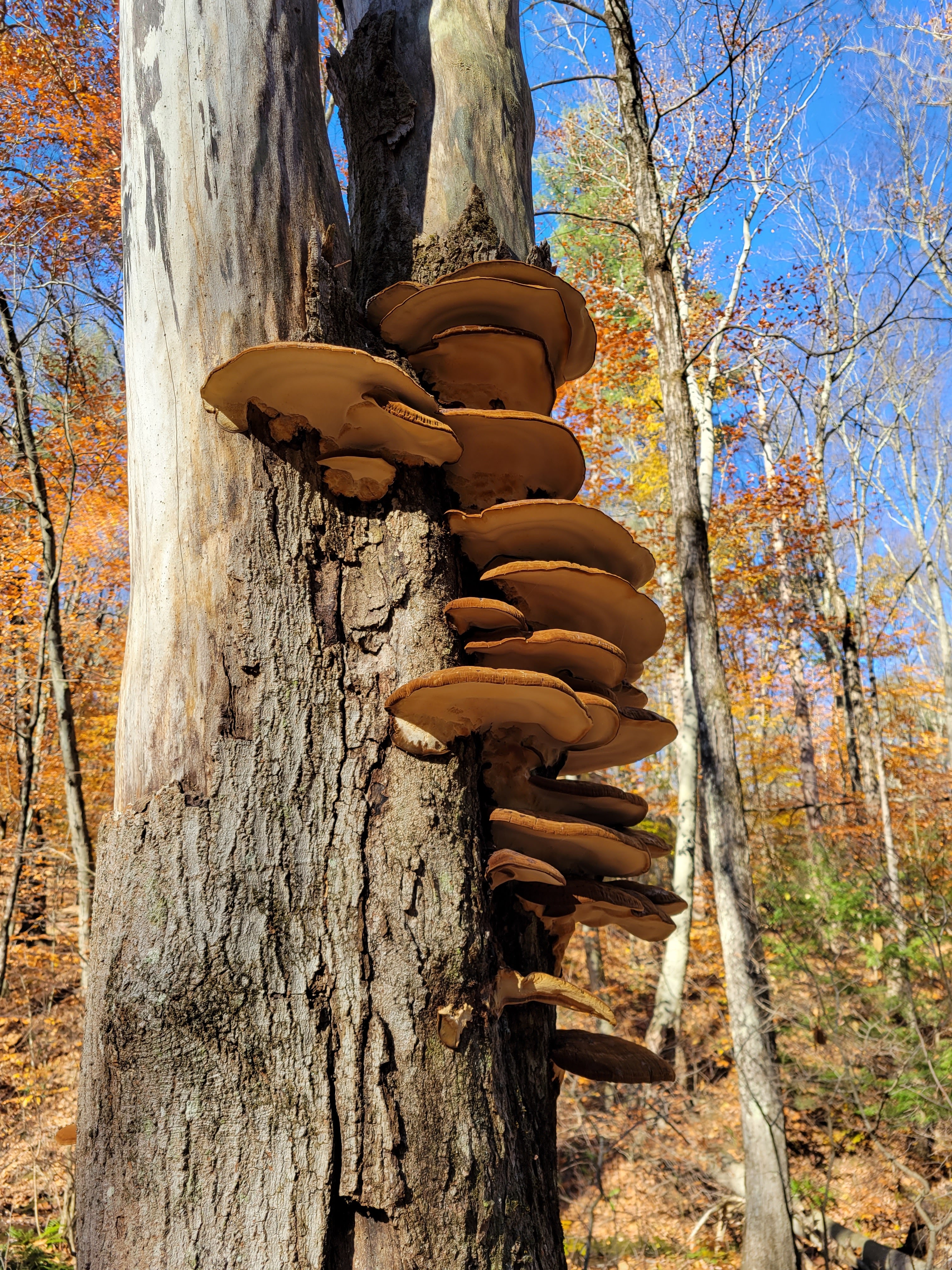
Past the quarry I found myself in a beautiful little valley following a creek down to the slightly more developed area around Lake Bray. I paused briefly to photograph some mushrooms and appreciate some small wetlands. It was also around here that I was finally able to get my sensor to calibrate properly and had to snack on a Clif Bar to prevent immediate low blood sugar.
After a short road walk to the next trailhead, my path finally turned upwards to the ridge of the Mount Tom Range. I powered my way up along the leaf littered trail, while more dried brown foliage still clung to the branches above. Apart from briefly going in a circle when I took a wrong turn, I made good time most of the way to the ridge. Eventually though, I had to slow my pace and stop my basal to accommodate some low blood sugar my earlier Clif bar had been unable to ameliorate.
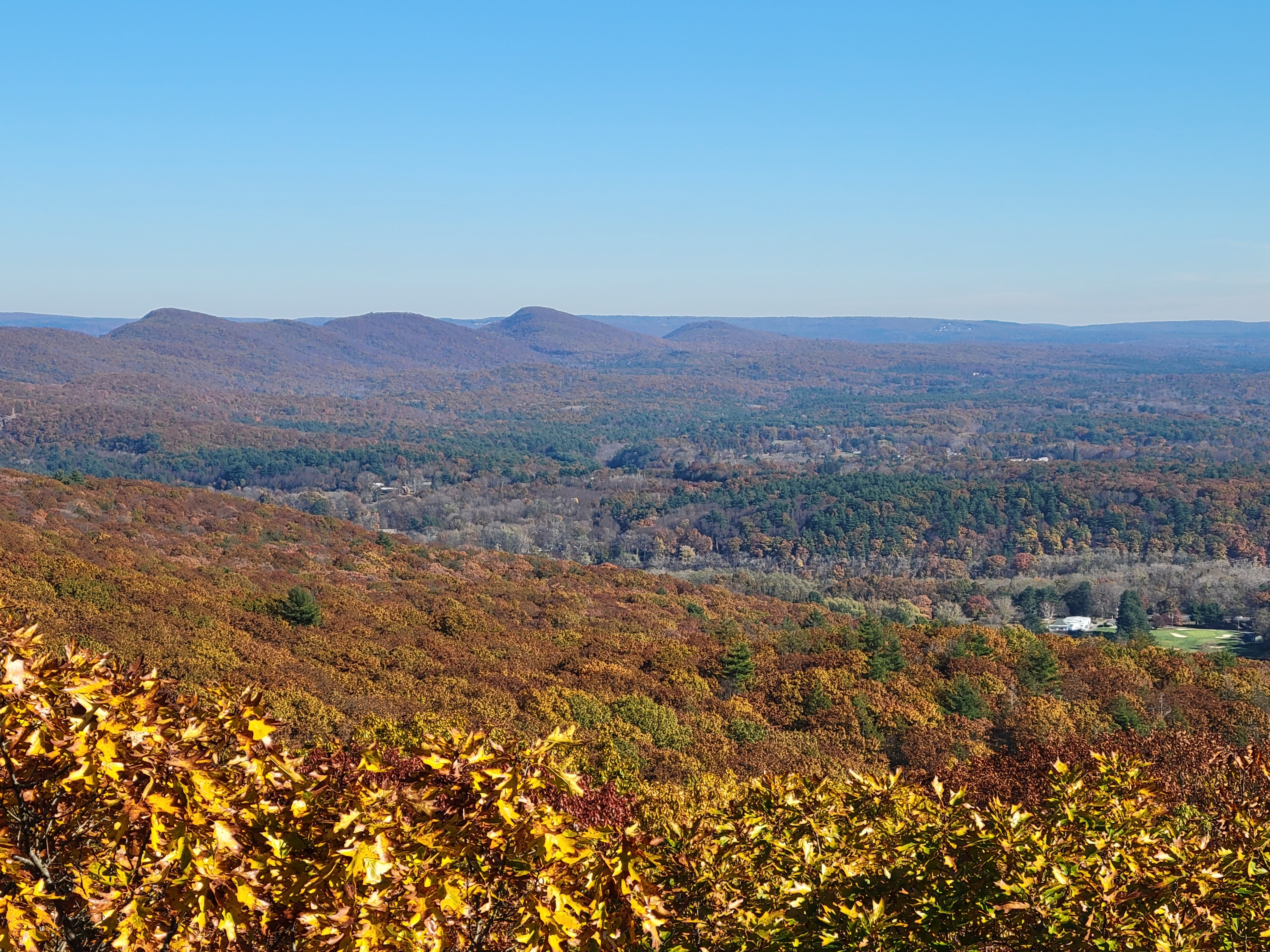
I made it to the familiar tower atop Goat Peak just after 12:00. My blood was cooperating slightly more, and I broke out the first half of my lunch while taking in the views. When I’m up there, it can almost imagine myself in some earlier time, keeping watch over the landscape for miles around, looking for signs of some encroaching army. The change in seasons since August was also clearly visible. The shapes of the land were the same, but where before everything was lush and green, it was now brown and tired, preparing for the long winter ahead.
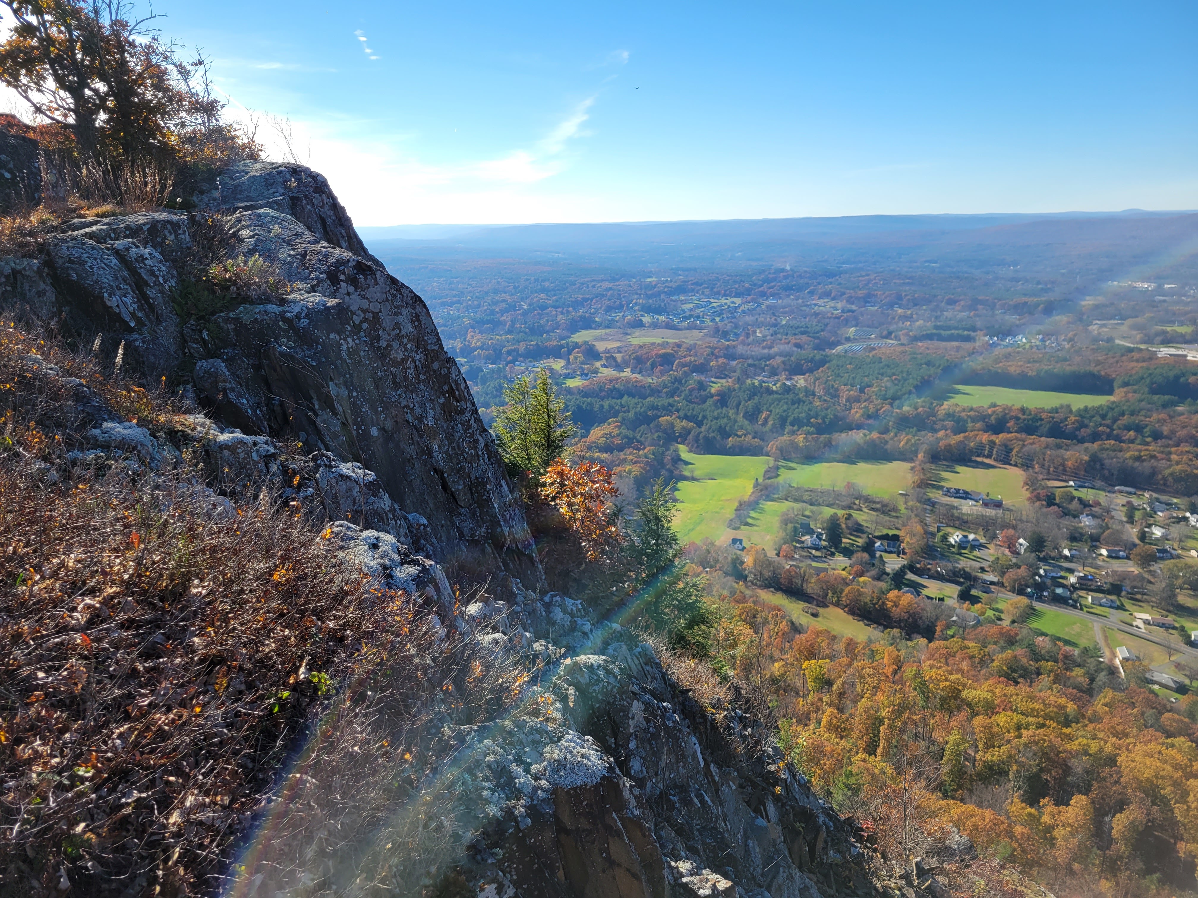
I could have happily stayed up there far longer, but I didn’t want my blood sugar to start creeping up too high, and I was still less than half done with day. Fortunately, the next section of the hike was spectacular. Heading south along the ridge of the Mount Tom Range I was greeted with view after view, looking west over rocky cliffs to Easthampton and beyond. I stopped for lunch at one of the overlooks and luckily, the cliff was short enough that I could climb down to retrieve my wrap after I knocked it over the edge.
After about two miles of stunning views I descended from the ridge into less rugged, less traveled terrain. A brief jaunt through rolling hills and trail hidden under fallen leaves brought me to the short road walk of the trip. I would not recommend it. The road had no shoulder, and where the path was supposed to start up again, I had to fight my way through nearly 100 yards of thick brush before I found anything that could remotely be considered a trail.
By the time I was back on a real trail, the sun was nearing the tops of the hills and the temperature was beginning to drop. As my hike was nearing its end, I found myself in a relaxed, almost meditative state. The leaves completely buried the trail crunched beneath my feet until I paused, letting the peaceful atmosphere and crisp autumn air wash over me. There are few feelings more wonderful than what I feel at times like that, at one with the world around me, the woes of life momentarily forgotten.

I finished last mile of the hike basking in that same mood just after 15:00. Even after the drive home, I still felt calm and nice for much of the remaining day. It was a stark reminder of how significantly my time outdoors can improve my mental state. I’m definitely making time to do this again next weekend.
Hike Details:
- Date: 11/7/2021
- Distance: 11 miles
- Route: https://www.alltrails.com/explore/map/map-november-6-2021-10-03-am-26657d5

Awesome commentary and pictures. Thankyou.
LikeLiked by 1 person