Today marks my first hike with companionship since moving last month. Maria finished her exams last week, so she finally had some time to come out with me to the woods. We continued section hiking the New England Trail (NET), this time starting just west of the Connecticut River. In contrast to the wet and rain of last week’s hike, or the burning 90°F weather of the days that followed, today was a very pleasant, overcast, 72°F (22°C).
Exiting the car, we followed a power line for about 100 feet before the trail turned left and started climbing up towards Mt. Nonotock. It was a nice gradual climb compared with my last two hikes in this area, which seemed determined to pick the steepest, most direct route up every hill.
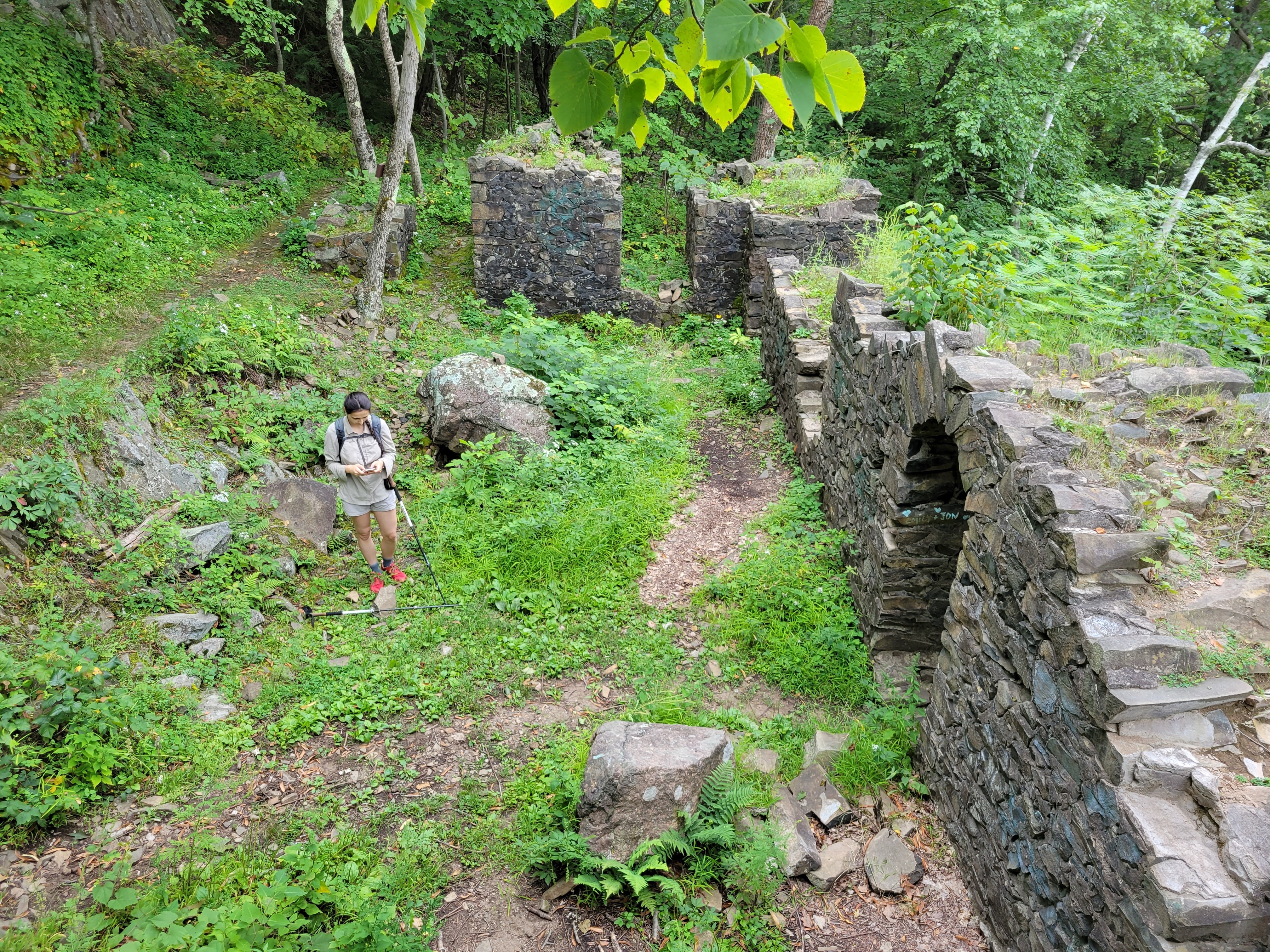
After about thirty minutes climbing up through the trees we came up to Christopher Clark Road. Rather than following the NET immediately across, we followed the road up to a little parking lot with a great view up north and discovered a trail leading around the ruins of an old summit house.

From a sign at the trailhead, we learned that the Eyrie House opened in 1861, and at it’s peak, it could house 30 guests, and had long, raised promenades all along the top of Mt. Nonotock to provide better views of the valley below. It burned down in 1901 after the owner got a little careless cremating a couple of dead horses, and because he was underinsured, he couldn’t afford to rebuild. All that’s left today is a few sections of stone foundation.
After about 45 minutes of exploring area around the ruins, we headed back down past the parking lot and got back on the NET. The next mile or so of trail followed along the ridgeline, up and over a hill called Dry Knoll, and towards Goat Peak. While there were only a couple of good vistas along this section, the forest was bright and fairly open. Maria stopped repeatedly to appreciate large beds of moss along the side of the trail.
This was also the section of the hike where my blood sugar started trying to crash on me. While we were slowly meandering around the ruined summit house, I had gotten hungry and eating my first cliff bar of the day (40g of carbs). Because of the slow pace, I’d decided to bolus for fully half of the carbs (moving at a normal pace, I wouldn’t bolus for more than 25%). Unfortunately after we started moving again, this turned out to be too much insulin, so as my blood started plummeting, I ate another 40g, this time without bolusing, to try to stabilize. We slowed down our pace, but by the time we reached Goat Peak, I was definitely low. Luckily, this also turned out to be a wonderful spot to pause and wait for my sugar levels to go back up a bit.
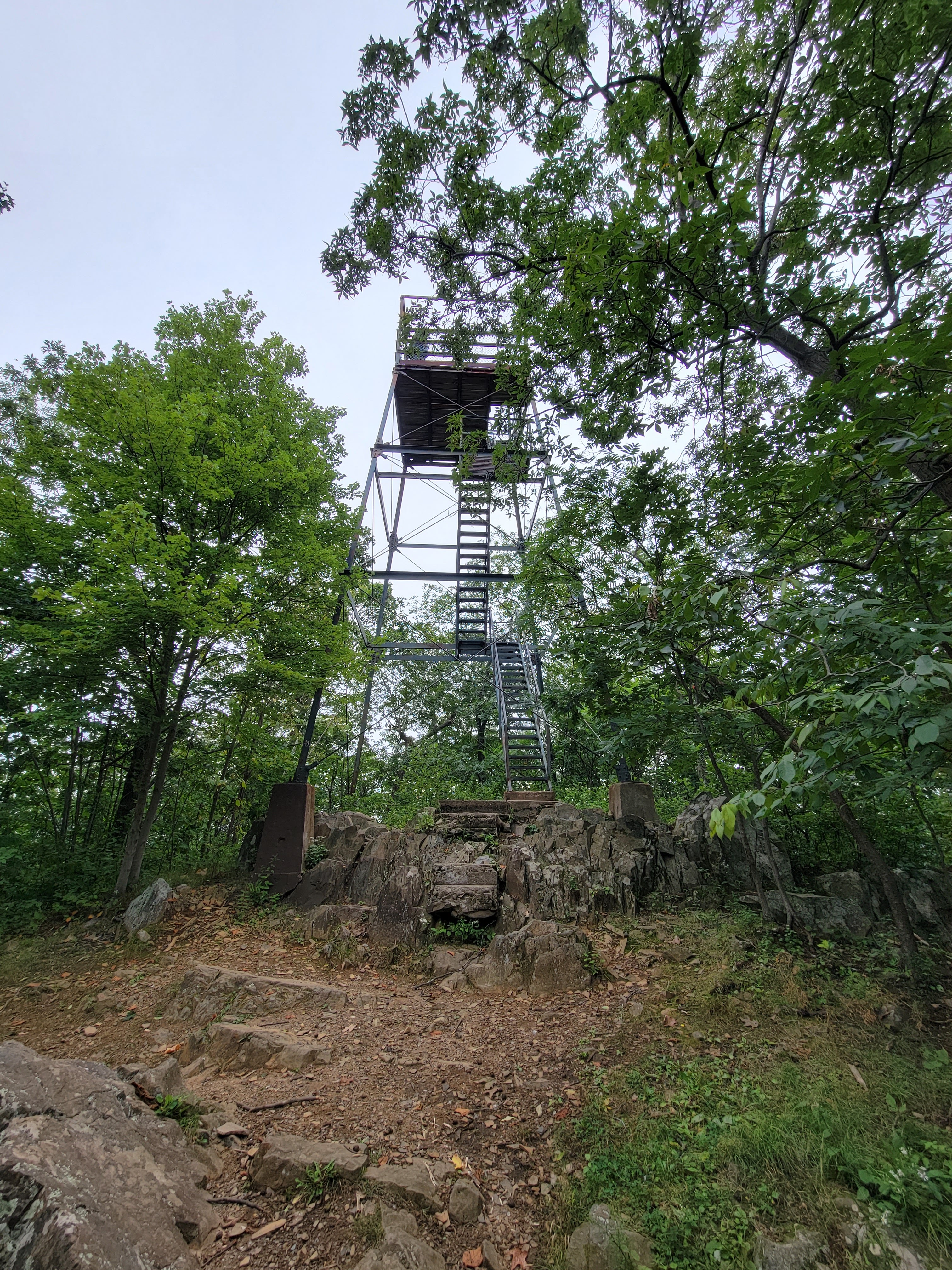
The highlight to the day, at least as far as views were concerned, was definitely the lookout tower on Goat Peak. Three levels of steep, rusted metal stairs lead to the top of the tower. As I climbed, I could feels the whole tower vibrating and see the ground dropping away below me. It took Maria two tries to make it to the top (she’s not particularly fond of heights), after a couple of birdwatchers with a big camera made their way down. It’s actually perfectly stable, but it sure doesn’t feel like it as you’re climbing up.
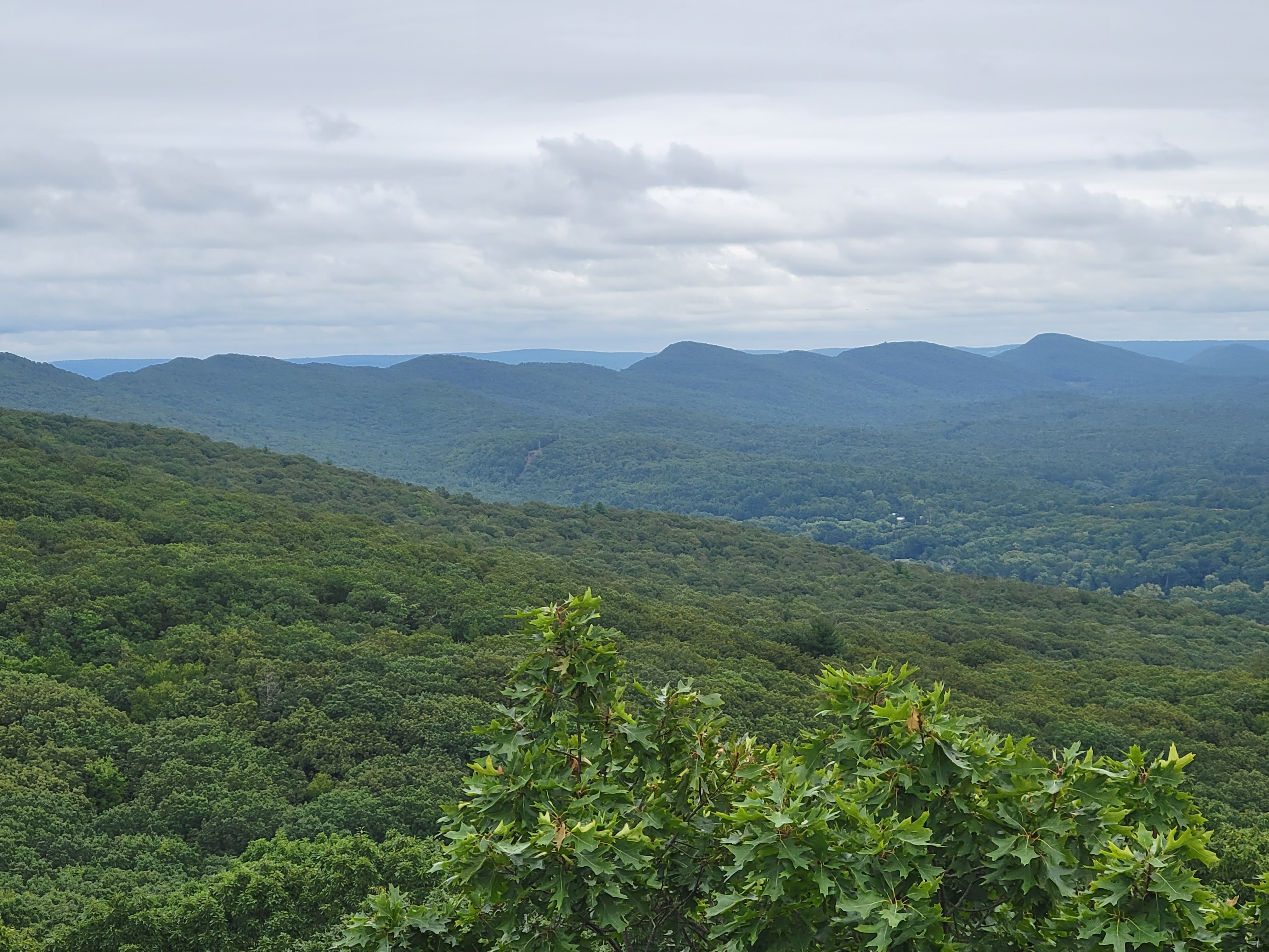
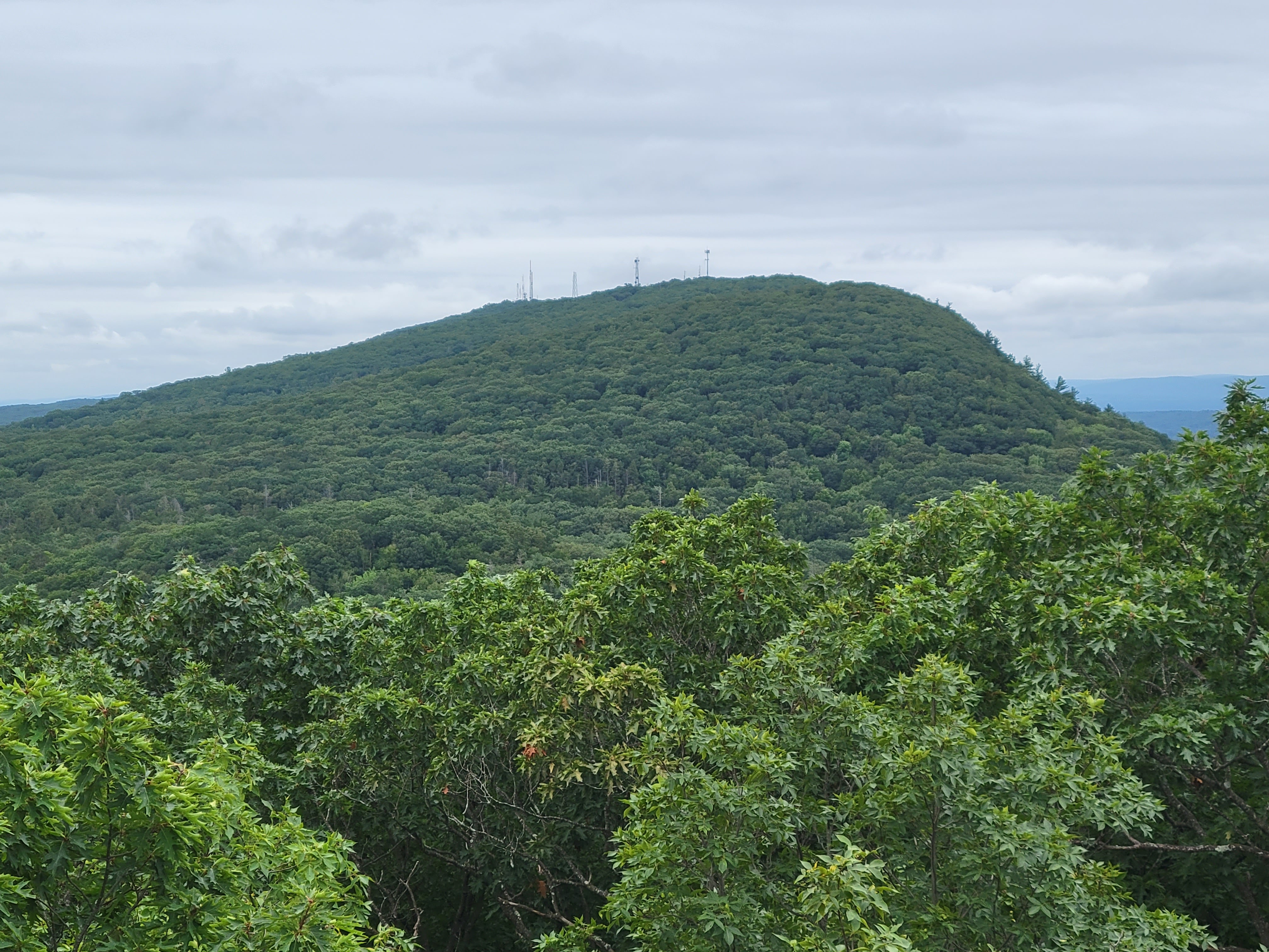
From the top of the tower, the whole landscape opened up around me. Mount Tom rises to the south, and I could see all of the Mount Holyoke Range to the north and west, fading a little with the distance. I could just make out the summit house on Mount Holyoke on the other side of the river, and it was really cool knowing that I’d hike along most, if not all, of that ridge in the last month. And further north past that, the tall building of UMass Amherst were also visible.
Maria’s mom was coming to visit in the afternoon, so we decided it was time turn around once we came down from the tower. On the way back we took a different trail that more or less paralleled our way out, but at a little lower elevation off the north side of the ridge. The forest didn’t change much, and the pattern of well graded trail continued for the rest of the return journey, in defiance of the New England standard. On the way, a couple of small stone foundations caught my attention, and made me wonder about their origins. My best guess is that they were somehow related to the Eyrie House, maybe part of the rail line that was being crafted up to the top, but I’m pretty clueless.

While heading back, I noticed my blood sugar starting to creeping up a little more than I wanted it to. It seemed the 40g I had eaten to balance my insulin was a little too much. Since we were going to be back at the car in less than 30 minutes, my insulin sensitivity would be back to normal soon, so I decided it was safe to give myself a larger dose of insulin. I again bolused for what amounted to half of the second 40g snack I’d consumed. This worked great, so my blood stabilized around 180 mg/dL, then settled back down around 120 mg/dL over the next hour or so.
We made it back to the car around 12:20, with plenty of time to get back home and nap before Maria’s mom arrived. Overall, it was a really nice, low key hike for the week. I think the views were above average for the area.
I generally like to push myself for speed and mileage when I’m hiking, so going out with Maria, who moves more slowly and takes more time pausing and appreciating the environment, requires a bit of a mindset change. There’s a fun whimsey and freedom that comes with a different pace, and being to just go off and explore something unexpected because I’m not worried about mileage. Had I not been with Maria, I likely would have just kept going along the NET rather than turning off to explore the ruins today, and I would have missed out. There’s definitely potential for friction between our two approaches, I find if I’m prepared for the different mindset ahead of time and the hiking plan allows it, there’s also a lot of value to be gained from embracing a different perspective. Would definitely recommend.
Hike Details:
- Time: 8:50 – 12:20, 8/29/2021
- Distance: 4 miles
- Route: https://www.alltrails.com/explore/map/map-aug-29-08-55-pm-9f8684e
